
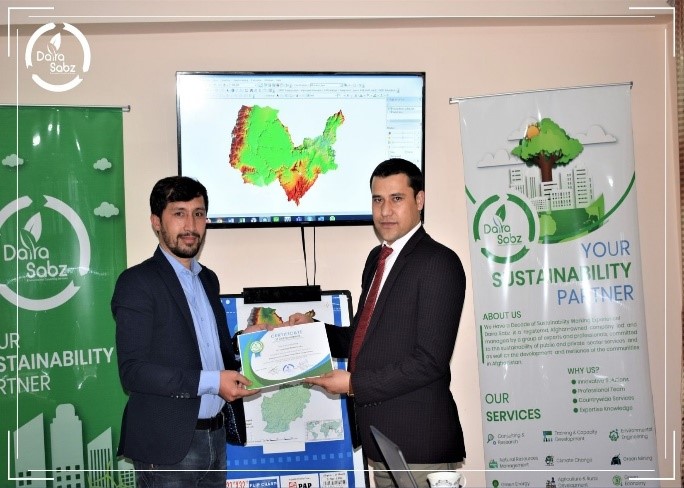
Advanced training course in GIS and Remote Sensing

Advanced Training Course in GIS and Remote Sensing
Overview
Geographic Information Systems (GIS) and Remote Sensing (RS) are essential technologies for analyzing, visualizing, and solving complex problems in today’s interconnected world. They support evidence-based decision-making across diverse fields such as natural resource management, urban development, environmental monitoring, disaster risk reduction, and sustainable planning.
This advanced training course provides participants with both theoretical knowledge and practical skills to apply GIS and RS in real-world contexts.
Recent Courses
- Employability Skills: Important Skills You Need to Invest
- Advanced training course in GIS and Remote Sensing
- Mobile Data Collection Using Kobo Toolbox
- Geographic Information Systems (GIS) Specialization
- Complex Problems and Sustainable Solutions: A Professional Training Course
- Environmental Sanitation Workshop
- Kobo Toolbox and Data Collection
- Professional Training on Community Based Disaster Risk Management (CBDRM) in Afghanistan
- Professional Training on Environmental and Social Impact Assessment (ESIA) of Projects
- Water, Sanitation and Hygiene Monitoring and Evaluation
Course Objectives
Participants will be able to:
- Understand the fundamentals and advanced applications of GIS and RS.
- Use GIS and RS tools for spatial data analysis and visualization.
- Integrate quantitative and qualitative data into geographical analysis.
- Develop professional maps and analytical reports.
- Apply GIS and RS in sectors such as natural resources, urban development, and environmental protection.
- Identify and analyze challenges using remote sensing methods.
Course Structure
- Module 1: Introduction to GIS and Remote Sensing
- Module 2: Spatial Data Collection and Management
- Module 3: Remote Sensing Applications and Data Processing
- Module 4: Advanced GIS Tools and Analysis
- Module 5: Map Design, Visualization, and Reporting
- Module 6: Practical Exercises and Case Studies
Training Approach
The program is designed using interactive and practice-oriented methods:
- Expert-led presentations
- Hands-on exercises with GIS and RS software
- Case studies and group discussions
- Real-world problem-solving activities
- Peer-to-peer knowledge sharing
Certification
A Certificate of Completion will be awarded to participants who successfully complete the training program.
Training Approach
- Format: Available in-person, online, or hybrid
- Duration: Flexible (commonly 2–3 days)
- Target Audience: Students, researchers, professionals, and staff from public, private, and non-profit sectors
- Languages: English (with multilingual support available)
Why This Course?
- Delivered by professionals with expertise in GIS and RS
- Balanced focus on global standards and practical applications
- Designed to enhance both technical skills and strategic thinking
- Suitable for participants from diverse disciplines and backgrounds
Registration & Contact
For details on schedules, fees, and registration, please contact:
📧 Email: info@dairasabz.com
🌐 Website: www.dairasabz.com